Show the map
Lac des Evettes
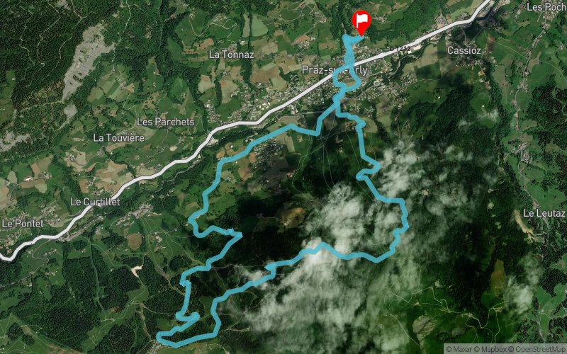


15.41 km
1567 m
1571 m
 Praz-sur-Arly (74)
 Praz-sur-Arly (74)
 Points of Interest table
| Accum. | Intermediary | |||||||
|---|---|---|---|---|---|---|---|---|
| POI | Description | Alt. | Dist. | D+ | D- | Dist. | D+ | D- |
Trace n°192913
Ascent threshold : 3 m Distance threshold : 0 m Smoothing : No Origin of altitudes : TrailConnect Android (baro) - GPS
Ascent threshold : 3 m Distance threshold : 0 m Smoothing : No Origin of altitudes : TrailConnect Android (baro) - GPS
Loop
Dominant terrain : Path
Max alti. : 1508 m
Avg alti. : 1230 m
Min alti. : 1005 m
Longest ascent : 500 m
Longest descent : 480 m
Route completed by the author : Yes
Dominant terrain : Path
Max alti. : 1508 m
Avg alti. : 1230 m
Min alti. : 1005 m
Longest ascent : 500 m
Longest descent : 480 m
Route completed by the author : Yes
Elevation profile
More tools
Create a new roadbook page
Map and track on your website
Warning ! When you insert a Trace de Trail map on your website, you agree not to hide any element of the module (links to Trail Trail or Trail Connect banner)
Add a realisation
Validate
Add a realisation to share your chrono and describe the conditions that you encountered during you trail running !
Add a comment
Validate
Show the infos
Add a track