Show the map
Certified Track - ITRA
NavyFroG Trail Challenges 2022 - NFG25
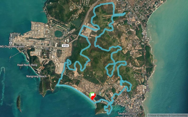


 Sattahip (TH)


Points of Interest table
| Accum. | Intermediary | |||||||
|---|---|---|---|---|---|---|---|---|
| POI | Description | Alt. | Dist. | D+ | D- | Dist. | D+ | D- |
 Competition organized on 06/17/2022
Trace n°181895
Ascent threshold : 3 m Distance threshold : 30 m Smoothing : Yes Origin of altitudes : MNT Google
Ascent threshold : 3 m Distance threshold : 30 m Smoothing : Yes Origin of altitudes : MNT Google
Loop
Dominant terrain : Path
Max alti. : 182 m
Avg alti. : 49 m
Min alti. : 0 m
Longest ascent : 140 m
Longest descent : 160 m
Dominant terrain : Path
Max alti. : 182 m
Avg alti. : 49 m
Min alti. : 0 m
Longest ascent : 140 m
Longest descent : 160 m
More tools
Create a new roadbook page
Map and track on your website
Warning ! When you insert a Trace de Trail map on your website, you agree not to hide any element of the module (links to Trail Trail or Trail Connect banner)
Add a realisation
Validate
Add a realisation to share your chrono and describe the conditions that you encountered during you trail running !
Show the infos
Add a track